
Cities around the world are successfully using Geographic Information Systems to help manage COVID-19. Why hasn’t Israel caught on yet?
Although most of Israel’s local municipalities are equipped with Geographic Information Systems (GIS), it seems that the platform is mainly recognized as a tool for urban planning and engineering. This mindset brings on a major missed opportunity, as we are overlooking additional capabilities of the GIS platform which could be extremely useful in managing urban crises, including the current COVID-19 pandemic.
GIS is a data driven, location-based platform that enables us to manage and analyze geographical data from various data layers. This helps support the decision-making process involved in both day-to-day life and during a crisis – As opposed to digital platforms which are based on phone identification (AD ID), and commonly used by the advertising industry to personalize marketing strategies.
The COVID-19 crisis has made the importance of location-based data very clear, as this is the only source which can uncover information on the number of people within households (hence the potential transmission rates). Moreover, we will observe how GIS can assist in keeping social distancing rules – and by doing so, assist in saving municipalities time, resources, and most importantly saving human lives.
To demonstrate this, we will bring examples of how cities around the world understood the importance of location-based data – hence the importance of GIS to fight COVID-19 – in contrast to the local municipalities in Israel who are woefully failing to take advantage of their existing technology.
How GIS helps manage the COVID-19 crisis
By using its spatial analysis capabilities, the GIS platform could map every space within a building or open territory, and automatically calculate the maximum number of people that could be present simultaneously according to social distancing policies.
For example, in the case of an educational institution, the GIS will map all classrooms, restrooms, and other spaces within the school. The mapping will inform decision makers in real time how many people could be in a certain space simultaneously, and therefore arrange student capsules accordingly.
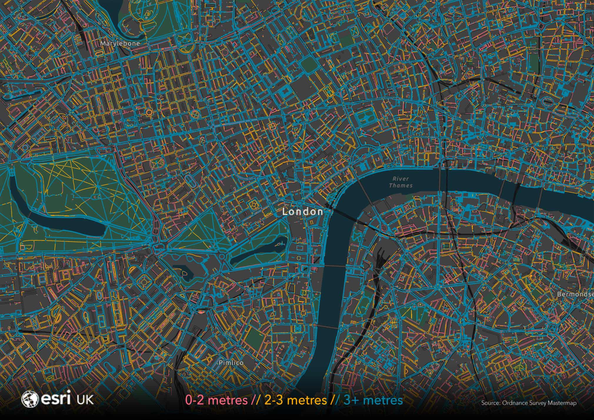
Another way GIS platforms have aided in our mission is by measuring the width of all sidewalks within cities, thereby cutting the hassle of manual work and saving valuable time and resources. The GIS analysis showed that most sidewalks measured less than 3 meters wide, thus not suited to comply with social distancing rules. In Milan, decision makers acted swiftly in order to widen the sidewalks and adapt them for social distancing measures (this was done by moving bike lanes at the expense of roads.)
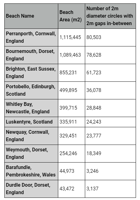
In England, where masses of people were concentrated in the beaches and violating the social distancing measures, the Government used the GIS platform to calculate the maximum number of people permitted at every beach and reduced virus transmission by doing so.
As evidenced by the examples above, the capabilities of GIS can be used to our advantage in more ways than one during this pandemic. For now, we can only hope that the local municipalities in Israel will realize the greater potential of this existing platform, which could save time, resources, and make the decision-making process more efficient.
